![]()
![]()
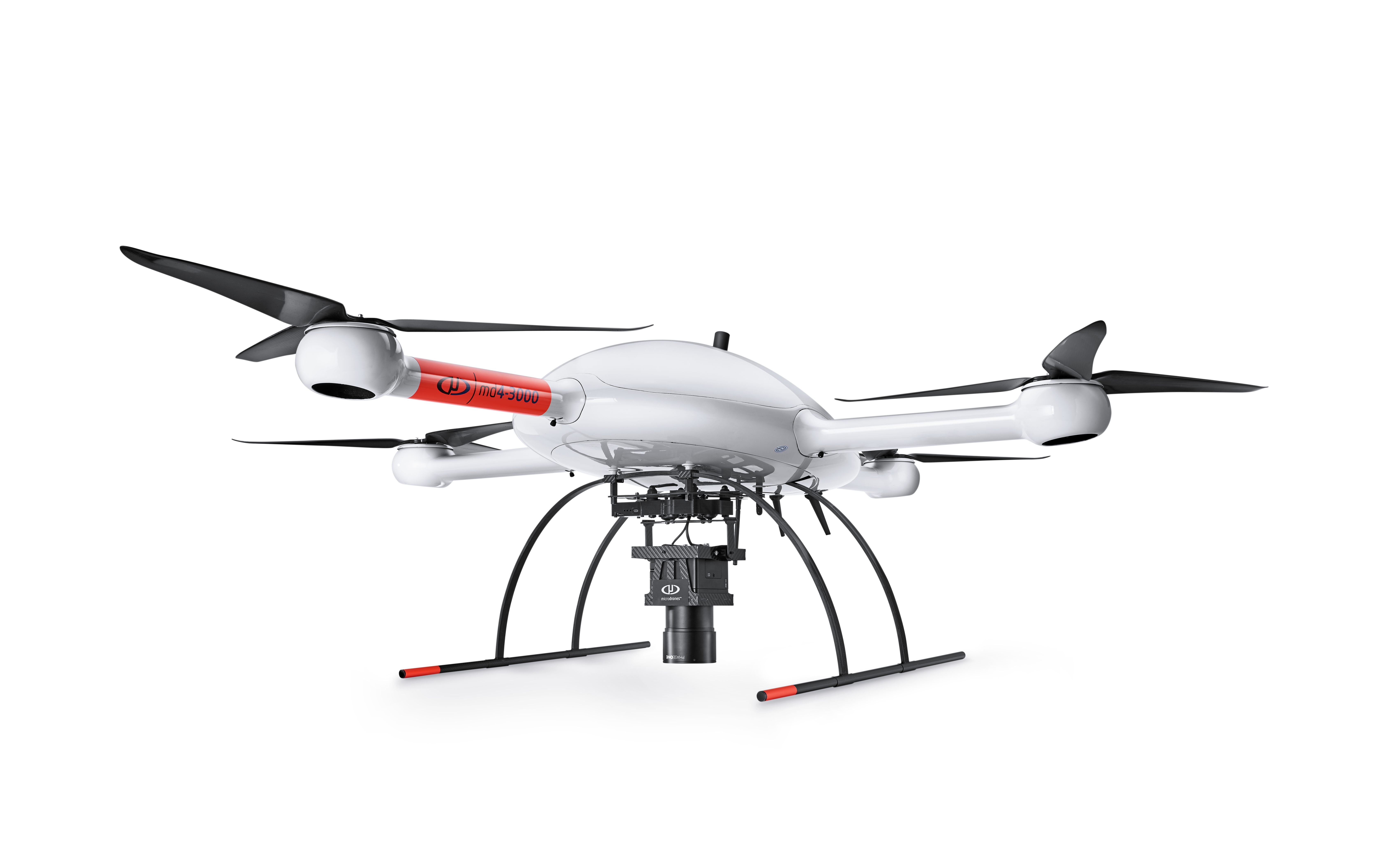
Microdrones is Taking Photogrammetry to New Heights with the mdMapper3000DuoG VHR
![]()
![]()
![]()
A NEW STATE OF MIND FOR MAPPING SERVICE PROVIDERS: WE PACKED MANNED AIRCRAFT AVIATION QUALITY INTO A UAV SYSTEM.
Very high resolution, Double the DG, triple the image quality, in just half the time*
Sometimes less isn’t more. With mdMapper3000DμoG VHR, you’ll quickly acquire highly dense and accurate data, in half the time. This system is designed, engineered and built for professional mappers to build professional grade mapping products.
The mdMapper3000DμoG VHR combines the lifting power, resilience and efficiency of the Microdrones md4-3000 aircraft platform, with a perfectly integrated Phase One camera and the power of direct georeferencing. This results in an unparalleled one pixel mapping accuracy from a 1000 ft. drone flight height.
*Note: Actual project completion times may vary based on desired surface coverage altitude flown, drone speed, desired mapping accuracy, and post processing methods.
![]()
Fill out the form below for more information: